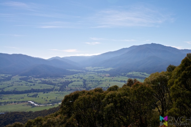
 As we chose to spend and extra night in Mount Beauty last night, we had to make up a little time today, which meant an early start. As we left town, we crossed a 900m pass that gave us great views of Mt. Bogon and the area around Mount Beauty.
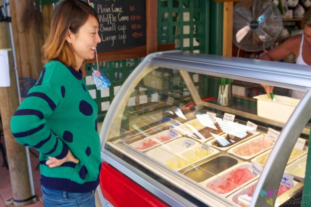 Over dinner last night we talked about things to see on the road today, and one of those things was an ice-creamery, though it wasn’t the ice cream that is usually the key attraction (it sounds horrible, but the lady serving was supposedly unnaturally well endowed, and watching her get ice cream from the front buckets was meant to be quite a treat). But… either we went to the wrong ice cream shop in Harrietville, or there was a new staff member. Anyway, it felt a little pervy, so wasn’t that sad. Lemon Ginger gelati was pretty good, which is what really mattered.
 Before starting on the Great Alpine Road we drove through pretty-as-a-picture Bright. Lots of cute houses/shops/cafes/restaurants and just as many ski/snowboard shops, too. I’m not sure if the trees are deciduous, but if they are, it would be spectacular in Autumn (it’s rather pretty in Spring, too).


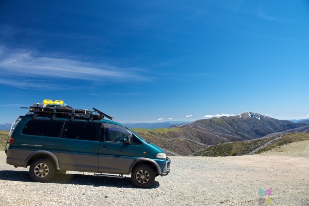 From the cute towns of Bright and Harrietville the road started rising, and didn’t stop rising until we got to Mount Hotham Resort at about 1800m. The views from the road were spectacular, almost as good as the views from Mt. Bogon yesterday, but without any of the effort. That same fire that ravaged Mt. Bogon also passed through here, only there didn’t seem to be the new growth that Bogon had. The fire must have been enormous, as there didn’t seem to be much left untouched.

 While the way up to Hotham was all forest (mostly burnt), the way down was almost all pastoral. The way up seemed to be quite steep and twisty (with quite a few sadistic cyclists making their way up), the way down seemed to be much more gradual and straight. It felt like an eternity before we came back below 1000m. Absolutely stunning location for a farm though, lush green hills with giant (for Australia) mountains behind.
Our destination for today is Thredbo to climb to the top of Mt. Kosciuszko, Australia’s tallest mountain (2,228m). Time was of the essence and the quickest way from the Great Alpine Road was via a long, narrow road… which got even narrower… and then turned to gravel… which lasted for more than 60km. It was steep in places and travelling was slow – but at least it wasn’t corrugated. Sadly, all of the winding roads were making Risa feel motion sick, so she tried to sleep through it.
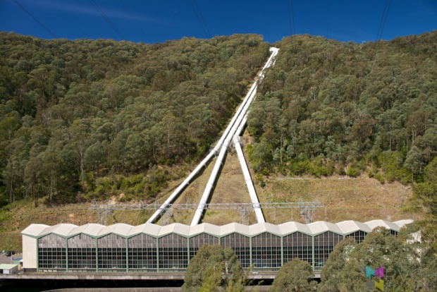 The minor road eventually joined the main road into the Snowy Mountains, which eventually started into more climbing. Endlessly, climbing. We were getting close, but it was getting late, and we were going much slower than I’d wished. I was starting to get nervous, as the last lift up the hill is at 4:30, and it was already 4PM. We saw one of the main power stations in the Snowy River Hydroelectric Scheme, which was one of Australia’s largest construction projects. The stats are phenomenal, this power station alone can be fed by up to 250,000L/second! All this water goes to produce just shy of 1 Giga watt! (or enough for about one million houses). I could go on with the electrical engineering stats, but if you’re interested, a quick Wikipedia on it will satiate your curiosity better than I ever could – http://en.wikipedia.org/wiki/Snowy_Mountains_Scheme
We kept chugging along, being overtaken by dozens of motorbikes all the way and eventually made it to Thredbo. It’s a tight/narrow ski village, and it took a while to find the lifts at the bottom of the village. It was now 4:20PM. I rushed to the ticket office to buy two one-way tickets, but it looked like we were too late – the 4:30 last lift was 4:30 from the top, not 4:30 from the bottom, not that I could see the difference. Anyway, obviously, they agreed to let us on, so I paid the (rather high) $27 each for a single ride on a twin chairlift. He surprised me a little though… I thought it was a 6.5km return hike from the top of the lift… turns out that it’s a 6.5km one-way, and that is from the top of the other lift, which is another 1km walk to. So, we were looking at a 15km return hike, plus a 4km walk down the slope, all to be completed in the 3 hours before the sun goes down… I had very brief second thoughts – maybe this was a bad idea…

 Anyway, I put that out of my head and rushed with our tickets to the chairlift. It’s so weird to walk onto a chairlift, rather than sliding onto it. It was a surprisingly long way up, and it took quite a long time to get to the top. There was an amazing set of cascades that was trickling down a valley to our right.
We had to climb for a little while to get to the start of the summit track and it was quite rough and unformed. But, once we got to the start of the summit trail, it was almost too flat/smooth. Basic mathematics told me that if we were to make it back to the car before it got too dark, we’d have to walk at about 6kph, which is a fairly brisk walking pace. I could see that Risa was struggling a little, and after a little discussion, she realised that she wasn’t going to be able to do it today (she still wasn’t feeling that well). We considered the options (continuing on slowly, her waiting, her returning solo) and decided that it was probably safest for her to return solo. Unlucky for her, the lifts had already stopped running, so she was going to have to walk down. Understandably, she wasn’t that happy about walking down by herself, so it was fortunate timing when we saw two young guys that were walking towards us, headed for bottom of the mountain. I passed Risa on to the two German boys, and they returned down together, which made Risa feel much safer.
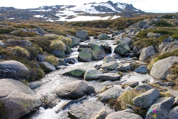

 Now I was free to push on to the summit. The trail started as pavement, and eventually turned in to a raised steel walkway. I thought it was weird at first, but realised that most of the ground underneath was quite swampy. The path was reasonably flat, too – only a small elevation gain over the 6.5km. It was actually quite a beautiful walk, I really loved all the rugged granite boulders.
 There was a lookout at the 2km mark which gave me my first glimpse of Kosciuszko. (it’s the round one in the middle)
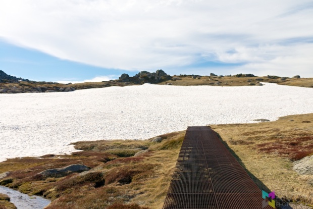

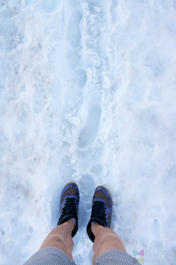 At one point the (boring, but understandably necessary) walkway disappeared underneath the snow. I thought it was a bit of novel fun, having to hike through the slushy snow …until the snow started getting inside my shoes. Closer to the summit, it happened more and more frequently, and it stopped being fun and started to become hard work and annoying.
I’d managed to keep a fairly fast walking pace, with the occasional jog thrown in to gain some time. There were lots of warning on the walkway not to run/jog, and they were right, it was very slippery, especially after walking through the snow… I had a few moments…
 I took a quick ‘rest’ at the highest toilet in Australia at Rawsons Pass (2100m) before making the final push to the summit. They did a good job of making the bathroom look inconspicuous, looking very much like an underground bunker. Previously you could drive as far as Rawsons Pass, making it a fairly easy 3km return hike to the summit, but now access is limited to National Parks personnel only… The trail changed to gravel pavement and wound in a big anti-clockwise loop around the peak of Mt. Kosciuszko. There was even more snow to walk through, and this time it was much deeper, steeper, slipperier and longer…
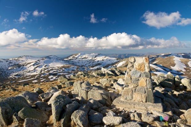

 But, I’d made it to the top! My feet were sore (my shoes are horrible), but otherwise I was feeling surprisingly good, especially considering I’d just backed up from a decent hike yesterday. The skies were clear, and the view to all the other snowy peaks was incredibly gratifying. The sun still looked reasonably high in the horizon, so I took a few moments to savour the surroundings. As far as mountains go, Mt. Kosciuszko is fairly tame, more of a very high hill than a craggy mountain peak. But, science says that it’s the highest place in all of Australia, so standing on the survey marker made me the highest man/woman/child/thing in Australia! Suck it all you lowlanders…


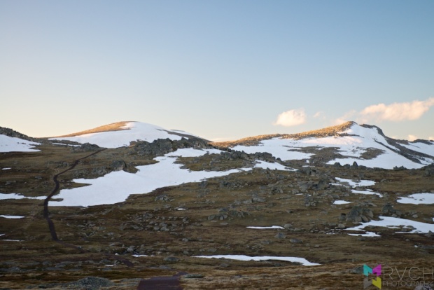 With sun starting to get low in the sky, and the trail now in shadows, I put on a thin hoody underneath my wind jacket – now that I wasn’t fighting gravity, I wasn’t working as hard and consequently I wasn’t as warm. But, the gravity assist did let me keep up a good pace and before I knew it I was back at the top of the resort (that’s a lie, it still took ages and I wished again for headphones). Actually, it’s funny how quickly you forget pain and only remember the triumphs. My feet were in agony the whole way down. Many years ago I pinched a nerve on the underside of my left foot, and after a lot of walking I get shooting pains up my left leg, which I felt with every other step. The water in my shoes from walking through the snowy trail had made my feet soggy, which had allowed a giant blister to grow on my right foot, so the other step, when I wasn’t getting shooting pains up my left leg, also felt painful, though more bearable. Pain aside, the main thing that was slowing me down were all the photo breaks.
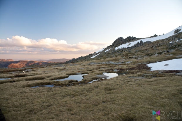


 I’d rushed up, but allowed myself a few minutes on the way back to capture the view. It wasn’t much of a sunset, but it the different light made everything look …different.
 The sun had officially set by the time I got back to the chairlifts, but there was still a reasonable amount of twilight illuminating the ground. It was dim, but I could safely make out where to go. Though, I decided (with the added advice of Risa) that walking down the long and windy Nature Trail wasn’t going to be my best option, so I decided to just walk down the slope underneath the chairlift. I followed the downhill mountain bike trail for a while and wished so hard that I could have a bike (with a light) to ride down the trail. It wasn’t anything too extreme, just a lot of berms and switchbacks (at least as far as I followed it). They were still getting the trail ready, so even if I had a bike, I’d be breaking the rules by riding down the course…
Walking down the grassy slope was hard work. It was muddy/boggy in places, and extremely slippery in others, but basically steep everywhere. I slipped several times (and left awesome grass stains on my favourite shorts). My knees were screaming, my feet still hurt, but I could now see the lights of Thredbo Village at the bottom of the hill so I knew that I was on the home stretch. I made it nearly halfway down before I had to use the light on my phone to light the way. Obviously not a real substitute for a torch, but in my rush to get to the chairlift I didn’t think to pack one in my bag… I was also glad now that I wasn’t using my phone to listen to music, either – it was a clear and moonless night and the starlight wasn’t enough to light my way. I could see 1-2m in front of me, so it made picking a path a little hard, but at least following the chairlift I knew I’d get to the right place, even if it took me over a small creek and down some very steep muddy sections.
I eventually made it back to the car a little before 8:30PM, which is about an hour after sunset, and a little less than 4-hours after starting. I was a shattered man, these days of hiking had taken a toll on my legs. I was ready for bed, and luckily it was only a 15 minute drive to Thredbo River National Park. Oh, and I was super grateful for Tomoko’s leftover pasta from last night’s dinner!

1 Comment
1 Pingback